I am starting to include the experiences of others in my maps. This (or a version of this) will be part of an exhibition in June:
Expo ’11!
3 MayI’ll be in Montréal, Quebec all next week participating in an innovative program called DesignInquiry. DI describes itself as “a non-profit educational organization devoted to researching design issues in intensive team-based gatherings. An alternative to the design conference, it brings together practitioners from disparate fields to generate new work and ideas around a single topic.” The topic of this gathering is the city of Montréal itself, which is the first and only North American city to be recognized by UNESCO (United Nations Educational, Scientific, and Cultural Organization) as a “City of Design.” According to DesignInquiry:
From the cultural legacy of Expo 67 and the 1976 Olympics, to numerous examples of contemporary creative work including art, fashion, performing arts and architecture, Montréal is clearly a creative hotspot. Its languages, its prejudices, its line-ups, la mode: all of these elements inform Montréal’s global disposition and local temperament. So, are design qualities somehow inherent in Montréal’s topographies, its citizens, its outputs? What makes a “City of Design” more relevant or significant than any other similarly vaunted location? Are these qualities designed by designers or do they evolve out of the way people use the city? Can we identify the characteristics of the dialog between the city and its users? (Can we emphasize the dialog by adding something or taking something away?)
The notion that design practice, and the presence of designers, can alter the trajectory of a city for the better is an assumption that beseeches exploration and testing. Meeting Montréal’s flora and fauna—getting used to its habits and communicating with its inhabitants will be the core of DesignInquiry-slash-Montréal. We are there as designers, exploring this design town.
I am most excited to participate in this exploration precisely because Montréal is one of the few major North American cities I haven’t yet explored. Visiting a new metropolitan area has always been a big deal for me. Call me a dork, but I love to pour over maps (duh), written histories, and guide books before I visit a new city. I know I’ve done my research when someone on the street asks me for directions, and I can actually help them out. Yeah… ok… I’m a dork.
When I applied for this program a few months ago, my knowledge of Montréal was limited to these few subjects:
1. Expo ’67 (thanks mostly to a They Might Be Giants song)
2. The 1976 Olympics
3. My childhood neighbors, who lived there briefly after moving from Belgium
4. Poutine (knowledge of)
5. The really weird logo of the (now-defunct) Montreal Expos
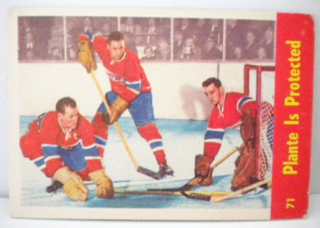
6. The Canadiens (Original Six, right?)
and
7. Leonard Cohen.
What will this list look like two weeks from now? The anticipation is killing me!
Where the rivers have no name.
30 MarDear Design 3,
Here is the article I was telling you about this morning in critique. It’s about the failure of the Google Map to label the names of rivers. It’s a quick read, and very entertaining.
XOXO,
K C-L
Josh Wallaert: “Google Maps, Give Us Our River Names.” Design Observer. 3/22/11
Rolling down the river in transit map style
24 FebCheck out Daniel P. Huffman’s interpretation of the Mississippi River system, designed in the style of the contemporary transit map. Of course, you are missing the delightful organic twists and turns, but clarity is gained, and it’s all pointing towards New Orleans. I grew up on the St. Croix River, and crossed the Mississippi nearly every single day as an undergrad, as it divided the campus of the University of Minnesota. When I was in grad school, I crossed the Iowa River daily, which divided the campus of the University of Iowa. And though it isn’t pictured on this map (because it runs north into Lake Michigan), I find it continually amusing that I cross the Fox River not once, but twice to get to work each day.
There is something very powerful about a river. They are complex, living things–and they draw a beautiful line, however you choose to interpret it. Boundary, navigational system, watershed….
Huffman is a lecturer on cartography at UW Madison, and has this to say about the project:
Rivers have been a key part of urban life for centuries. They have provided us with drinking water, protection, and a transit network that links us from one settlement to the next. I wanted to create a series of maps that gives people a new way to look at rivers: a much more modern, urban type of portrayal. So I turned to the style of urban transit maps pioneered by Harry Beck in the 1930s for the London Underground. Straight lines, 45º angles, simple geometry. The result is more of an abstract network representation than you would find on most maps, but it’s also a lot more fun. The geography is intentionally distorted to clarify relationships. I think it helps translate the sort of visual language of nature into a more engineered one, putting the organic in more constructed terms. Not every line depicted is navigable, but all are important to the hydrological systems shown.
Rulebreaker
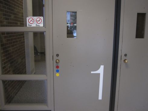
22 FebThe other day, a student pointed this sign out to me. I’ve probably walked by it thousands of times while entering the building where I work without paying any attention. No food or drink in the A/C? Really? The vending machines just inside the door should be ashamed of themselves. Here I sit in my office upstairs, drinking coffee behind closed doors like a criminal!
But, seriously, if signs don’t make any sense, why read them? I just find it interesting that I’ve ignored this sign for seven whole years. In general, I’m very observant, almost to a fault.
Next, I’d like to know why the outer set of doors are newly handicapped accessible (finally!) while all of the vestibule doors still have manual knobs. It’s either that or the stairs.
You saw it here first.
4 NovHere, at long last, is the follow up to the “Personal Subway Map” I made back in 2002 (below). Times have changed. Life has gotten more complicated. And Iowa has turned into Wisconsin. You can see a much higher-res version of it at the Faculty Show, which goes up at the Priebe next week.
My favorite part right now? The Highly Successful Scott Walker Passenger Rail Line to Madison.
Another fine example of imaginative mapping.
22 OctYears ago, when I worked in a wonderful bookstore, I remember seeing a really cool book containing imaginary blueprints of classic television homes. The Brady Bunch house was definitely in there. And I think it also contained the New Rochelle, N.Y., house from the Dick Van Dyke show as well as Andy Griffith’s Mayberry pad. I don’t know about you, but when I spend serious time with a television show or a movie, I can’t help but compose and imagine the layout of the show’s environment in my head.
Imagine, then, the delight I felt this morning when I came across this rendering of the Manhattan offices of Sterling Cooper Draper Price. I’ve spent part of this week depressed that we’ve come to the end of another thrilling season. (Er, marriage proposal?!) But at least I can take an imaginary stroll though the offices… though I’m not convinced yet that Roger has a corner office. But it is true that he does have the best lamp in the biz.


